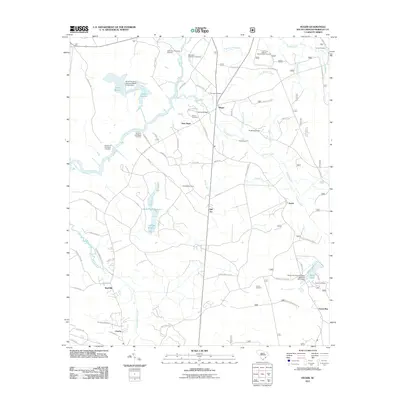
2011 Map of Huger
USGS Topo · Published 2011About this map
The settlement of Huger anchors this Berkeley County landscape, where the confluence of historic plantation grounds and modern conservation efforts is clearly visible. The map preserves the locations of several burial sites, including the Silk Hope Plantation Cemetery, Hyde Park Plantation Cemetery, and a Slave Cemetery near New Hope, offering critical documentation for genealogical research. The waterway network is dominated by the East Branch Cooper River and the Huger Creek drainage, which includes specialized water management features like the Hard Pinch Reserve, Leneigh Reserve, and the Turpentine Dam. These reserves and canals, such as the Hester Canal, reflect a long history of water control for agriculture and industry. Cultural landmarks like the Quinby Bridge and the Francis Marion Seed Shelter Orchard point to the area's ongoing significance as both a site of local history and specialized resource management.
Find a feature on this map
83 named features on this map. Tap any name to fly to it.
Don’t see what you’re looking for? This feature index may not catch every label — zoom into the map to look around manually.
Map Details
Editions of this 2011 Huger Map
This is the sole edition of this map. No revisions or reprints were ever made.
Other maps of this area

1919 · Wando
USGS Topo · 1:21,120

1919 · Cordesville
USGS Topo · 1:48,000

1919 · Melgrove
USGS Topo · 1:21,120

1919 · Sewee Bay
USGS Topo · 1:21,120

1940 · Melgrove
USGS Topo · 1:24,000

1943 · Wando
USGS Topo · 1:24,000

1943 · Sewee Bay
USGS Topo · 1:24,000

1943 · Shulerville
USGS Topo · 1:24,000

1943 · Ocean Bay
USGS Topo · 1:24,000

1948 · James Island
USGS Topo · 1:250,000