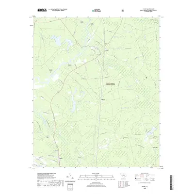
2020 Map of Huger
USGS Topo · Published 2020About this map
Francis Marion National Forest dominates this Berkeley County landscape, where the East Branch Cooper River and its numerous tributaries create a complex network of wetlands and swamps. The terrain is marked by significant plantation-era history, evidenced by the distribution of family and plantation burial grounds including Hyde Park Plantation Cem, Silk Hope Plantation Cem, and Richmond Plantation Cem. The map illustrates a transition from the deep woods and swamplands like King Swamp and Gobel Swamp to the small settlements of Huger and Charity. Water management and industrial history are visible through features like Hester Canal and various reserves such as the Upper Reserve and Lower Reserve, while Quinby Bridge serves as a key crossing point over Huger Creek. The extensive Swamp Fox/Palmetto Trail winds through the forest, connecting these historic sites.
Find a feature on this map
85 named features on this map. Tap any name to fly to it.
Don’t see what you’re looking for? This feature index may not catch every label — zoom into the map to look around manually.
Map Details
Editions of this 2020 Huger Map
This is the sole edition of this map. No revisions or reprints were ever made.
Other maps of this area

1919 · Wando
USGS Topo · 1:21,120

1919 · Cordesville
USGS Topo · 1:48,000

1919 · Melgrove
USGS Topo · 1:21,120

1919 · Sewee Bay
USGS Topo · 1:21,120

1940 · Melgrove
USGS Topo · 1:24,000

1943 · Wando
USGS Topo · 1:24,000

1943 · Sewee Bay
USGS Topo · 1:24,000

1943 · Shulerville
USGS Topo · 1:24,000

1943 · Ocean Bay
USGS Topo · 1:24,000

1948 · James Island
USGS Topo · 1:250,000