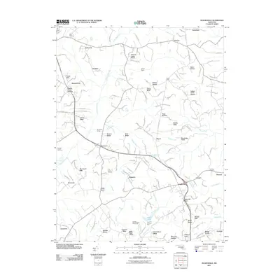
2011 Map of Hughesville
USGS Topo · Published 2011About this map
Bryantown and Hughesville anchor this southern Maryland landscape, where residential developments like Meadow Creek Manor and Gallant Acres intersperse with older crossroads and family holdings. The central drainage of Zekiah Swamp Run carves through the terrain, flanked by numerous smaller watercourses such as Mill-Dam Run and Gilbert Creek. Genealogy researchers will find several significant burial sites, including Saint Peters Cemetery near Bellewood and Saint Marys Cemetery north of Ridgeview. The area maintains a mix of established community hubs like Malcolm and newer residential clusters such as Serenity Woods, while unique landmarks like the Timbuktu Arabian Horse Farm and the Southern Maryland Public Works Camp highlight the diverse land use. This survey captures a period of continued suburban transition, showing the density of neighborhood names like Hickory Thicket and Woodridge Acres as they expand around the traditional town centers.
Find a feature on this map
174 named features on this map. Tap any name to fly to it.
Don’t see what you’re looking for? This feature index may not catch every label — zoom into the map to look around manually.
Map Details
Editions of this 2011 Hughesville Map
This is the sole edition of this map. No revisions or reprints were ever made.
Other maps of this area

1892 · Leonardtown
USGS Topo · 1:62,500

1892 · Prince Frederick
USGS Topo · 1:62,500

1892 · Brandywine
USGS Topo · 1:62,500

1894 · Wicomico
USGS Topo · 1:62,500

1895 · Prince Frederick
USGS Topo · 1:62,500

1895 · Wicomico
USGS Topo · 1:62,500

1895 · Brandywine
USGS Topo · 1:62,500

1895 · Leonardtown
USGS Topo · 1:62,500

1895 · Nomini
USGS Topo · 1:125,000

1898 · Nomini
USGS Topo · 1:125,000