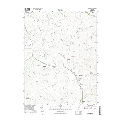
2016 Map of Hughesville
USGS Topo · Published 2016About this map
Zekiah Swamp Run and its extensive wetlands dominate the central corridor of this Maryland landscape, creating a natural divide between the settlements of Bryantown and Hughesville. The southern portion of the map reveals a transition toward Charlotte Hall and Grosstown, where the terrain begins to shift away from the dense hydrology of the Zekiah Swamp. Genealogists will find significant value in the distribution of religious landmarks, including the Old Fields Episcopal Church Cem and the Society of Friends Cem, which indicate long-standing community centers in this portion of Charles County. The northern reaches near Malcolm and the unique topographic feature known as Devils Nest reflect the rural, wooded character that persisted even as suburban expansion reached toward Waldorf in the late twentieth century.
Find a feature on this map
175 named features on this map. Tap any name to fly to it.
Don’t see what you’re looking for? This feature index may not catch every label — zoom into the map to look around manually.
Map Details
Editions of this 2016 Hughesville Map
This is the sole edition of this map. No revisions or reprints were ever made.
Other maps of this area

1892 · Leonardtown
USGS Topo · 1:62,500

1892 · Prince Frederick
USGS Topo · 1:62,500

1892 · Brandywine
USGS Topo · 1:62,500

1894 · Wicomico
USGS Topo · 1:62,500

1895 · Prince Frederick
USGS Topo · 1:62,500

1895 · Wicomico
USGS Topo · 1:62,500

1895 · Brandywine
USGS Topo · 1:62,500

1895 · Leonardtown
USGS Topo · 1:62,500

1895 · Nomini
USGS Topo · 1:125,000

1898 · Nomini
USGS Topo · 1:125,000