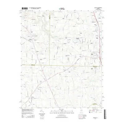
2014 Map of Hulaco
USGS Topo · Published 2014About this map
Brindley Mountain and the Tennessee Valley Divide define the high ground of this North Alabama landscape where Morgan, Marshall, Cullman, and Blount counties meet. The area is marked by a dense network of small agricultural settlements and crossroads, including Hog Jaw, Ryan Crossroads, and Joppa. Local history and genealogy are well-represented by numerous family and community burial grounds such as Hebron Cem, Corinth Cem, and Mt Hermon Cem. Waterways like Berry Cr and Canaan Br carve through the terrain, with infrastructure such as the Mill Pond Bridge indicating the historical reliance on local milling and stream crossings. The transition from the plateau down through Section Hollow and Moon Hollow illustrates the complex drainage patterns that influenced early road placement and farm locations across this multi-county border region.
Find a feature on this map
176 named features on this map. Tap any name to fly to it.
Don’t see what you’re looking for? This feature index may not catch every label — zoom into the map to look around manually.
Map Details
Editions of this 2014 Hulaco Map
This is the sole edition of this map. No revisions or reprints were ever made.
Other maps of this area

1885 · Gadsden
USGS Topo · 1:125,000

1888 · Cullman
USGS Topo · 1:125,000

1888 · Gadsden
USGS Topo · 1:125,000

1892 · Cullman
USGS Topo · 1:125,000

1892 · Gadsden
USGS Topo · 1:125,000

1895 · Gadsden
USGS Topo · 1:125,000

1903 · Gadsden
USGS Topo · 1:125,000

1936 · Guntersville Dam
USGS Topo · 1:24,000

1936 · Hulaco
USGS Topo · 1:24,000

1936 · Arab
USGS Topo · 1:24,000