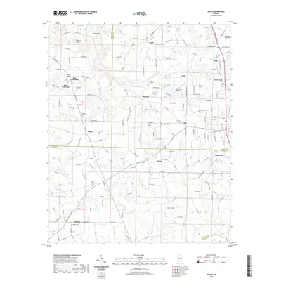
2020 Map of Hulaco
USGS Topo · Published 2020About this map
Arab and its surrounding rural communities occupy this high ground in north Alabama, where the Tennessee Valley Divide snakes across the landscape. The map highlights a series of small, interconnected settlements like Hulaco, Joppa, and Baileyton, each centered around historic crossroads and local landmarks. To the north, the terrain drops toward the Crawford Bottom and the winding Cotaco Creek, while the eastern portion of the sheet shows the residential growth of Sunset Acres and North Arab.
Find a feature on this map
187 named features on this map. Tap any name to fly to it.
Don’t see what you’re looking for? This feature index may not catch every label — zoom into the map to look around manually.
Map Details
Editions of this 2020 Hulaco Map
This is the sole edition of this map. No revisions or reprints were ever made.
Other maps of this area

1885 · Gadsden
USGS Topo · 1:125,000

1888 · Cullman
USGS Topo · 1:125,000

1888 · Gadsden
USGS Topo · 1:125,000

1892 · Cullman
USGS Topo · 1:125,000

1892 · Gadsden
USGS Topo · 1:125,000

1895 · Gadsden
USGS Topo · 1:125,000

1903 · Gadsden
USGS Topo · 1:125,000
1936 · Guntersville Dam
USGS Topo · 1:24,000
1936 · Hulaco
USGS Topo · 1:24,000
1936 · Arab
USGS Topo · 1:24,000