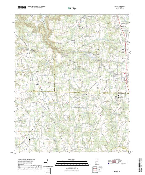
2024 Map of Hulaco
USGS Topo · Published 2024About this map
Brindley Mountain anchors the northeastern corner of this landscape, overlooking a network of agricultural communities where Morgan, Marshall, and Cullman counties converge. The high ground of the Tennessee Valley Divide dictates the flow of local waters, with northern drainages like Cataco Creek eventually heading toward the Tennessee River, while southern streams such as Warrior Creek feed the Black Warrior basin. This is a region defined by scattered crossroads settlements like Ryan Crossroads and Winn Crossroads, and small rural centers like Hulaco, Joppa, and Baileyton. Numerous landmarks reflect the deep-rooted local history of the area, including several historic burial sites like the Old Union Hill Methodist Cem and the Mount Hermon Cem. Small rural congregations such as the Eddy Missionary Baptist Church and Pleasant Grove Ch remain central to the community fabric, set against a backdrop of steep hollows and narrow creek bottoms.
Find a feature on this map
198 named features on this map. Tap any name to fly to it.
Don’t see what you’re looking for? This feature index may not catch every label — zoom into the map to look around manually.
Map Details
Editions of this 2024 Hulaco Map
This is the sole edition of this map. No revisions or reprints were ever made.
Other maps of this area

1885 · Gadsden
USGS Topo · 1:125,000

1888 · Cullman
USGS Topo · 1:125,000

1888 · Gadsden
USGS Topo · 1:125,000

1892 · Cullman
USGS Topo · 1:125,000

1892 · Gadsden
USGS Topo · 1:125,000

1895 · Gadsden
USGS Topo · 1:125,000

1903 · Gadsden
USGS Topo · 1:125,000

1936 · Guntersville Dam
USGS Topo · 1:24,000

1936 · Hulaco
USGS Topo · 1:24,000

1936 · Arab
USGS Topo · 1:24,000