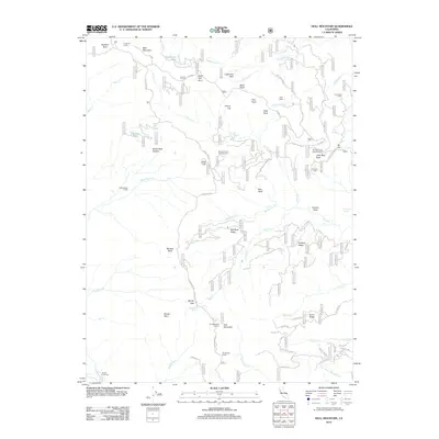
2012 Map of Hull Mountain
USGS Topo · Published 2012About this map
Hull Mountain and its high-elevation Hull Mountain Lookout anchor this section of the Mendocino National Forest, where the Eel River carves through a landscape defined by ridgelines and remote backcountry camps. The map documents a network of Forest Service infrastructure and historic recreation spots, from the Tar Flat Forest Service Facility to specialized sites like Millsap Cabin and Graves Cabin. The drainage patterns of Hull Cr and Mendenhall Cr illustrate the complex watershed that feeds into the Eel River system. For local historians and researchers, the detailed labeling of remote sites such as Hells Half Acre, Spruce Grove Campground, and Lee Logan Camp provides a precise record of land management and forest habitation in the early 21st century. High-altitude landmarks like Windy Point and Red Rock Ridge overlook a terrain marked by named springs and small lakes, including Barley Lake and Chipmunk Spring.
Find a feature on this map
73 named features on this map. Tap any name to fly to it.
Don’t see what you’re looking for? This feature index may not catch every label — zoom into the map to look around manually.
Map Details
Editions of this 2012 Hull Mountain Map
This is the sole edition of this map. No revisions or reprints were ever made.
Other maps of this area

1922 · Hullville
USGS Topo · 1:62,500

1929 · Eden Valley
USGS Topo · 1:62,500

1943 · Pomo
USGS Topo · 1:62,500

1951 · Lake Pillsbury
USGS Topo · 1:62,500

1952 · Hull Mountain
USGS Topo · 1:62,500

1952 · Eden Valley
USGS Topo · 1:62,500

1957 · Ukiah
USGS Topo · 1:250,000

1960 · Ukiah
USGS Topo · 1:250,000

1960 · Potter Valley
USGS Topo · 1:62,500
1966 · Sanhedrin Mtn
USGS Topo · 1:24,000