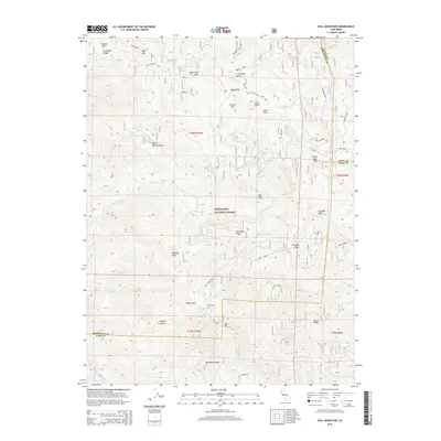
2015 Map of Hull Mountain
USGS Topo · Published 2015About this map
The Eel River winds through the northern reaches of the Mendocino National Forest in this 2015 study of the borderlands between Lake, Glenn, and Mendocino counties. The landscape is defined by its dramatic geologic features and ridges, including the prominent Hull Mtn and the curious Devils Rock Garden. Of significant local interest is the marking of Hulls Grave near Windy Gap, providing a rare named historical marker in an area otherwise dominated by the natural features of the National Forest. The terrain transitions from the high points of Panther Ridge and Boardman Ridge down to established water bodies like Barley Lake and Cushman Lake. Small clearings and notable landmarks like Hells Half Acre and Monkey Rock are meticulously mapped alongside the network of forest roads and creek beds that drain the eastern slopes.
Find a feature on this map
53 named features on this map. Tap any name to fly to it.
Don’t see what you’re looking for? This feature index may not catch every label — zoom into the map to look around manually.
Map Details
Editions of this 2015 Hull Mountain Map
This is the sole edition of this map. No revisions or reprints were ever made.
Other maps of this area

1922 · Hullville
USGS Topo · 1:62,500

1929 · Eden Valley
USGS Topo · 1:62,500

1943 · Pomo
USGS Topo · 1:62,500

1951 · Lake Pillsbury
USGS Topo · 1:62,500

1952 · Hull Mountain
USGS Topo · 1:62,500

1952 · Eden Valley
USGS Topo · 1:62,500

1957 · Ukiah
USGS Topo · 1:250,000

1960 · Ukiah
USGS Topo · 1:250,000

1960 · Potter Valley
USGS Topo · 1:62,500
1966 · Sanhedrin Mtn
USGS Topo · 1:24,000