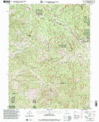
1996 Map of Hull Mountain
USGS Topo · Published 2001About this map
Hull Mountain dominates this portion of the Mendocino National Forest, where the complex topography of Boardman Ridge and Thatcher Ridge marks the boundaries of Glenn, Mendocino, and Lake counties. The landscape is dotted with the remnants of early mountain life, including historic locations such as the Millsap Cabin (Site) and Graves Cabin (Site), as well as the singular landmark of Hulls Grave. These sites, along with established backcountry outposts like Cushman Camp and Lee Logan Camp, suggest a history of seasonal residence, forest management, and outdoor recreation in the decades following the mid-century.
Find a feature on this map
58 named features on this map. Tap any name to fly to it.
Don’t see what you’re looking for? This feature index may not catch every label — zoom into the map to look around manually.
Map Details
Editions of this 1996 Hull Mountain Map
This is the sole edition of this map. No revisions or reprints were ever made.
Other maps of this area

1922 · Hullville
USGS Topo · 1:62,500

1929 · Eden Valley
USGS Topo · 1:62,500

1943 · Pomo
USGS Topo · 1:62,500

1951 · Lake Pillsbury
USGS Topo · 1:62,500

1952 · Hull Mountain
USGS Topo · 1:62,500

1952 · Eden Valley
USGS Topo · 1:62,500

1957 · Ukiah
USGS Topo · 1:250,000

1960 · Ukiah
USGS Topo · 1:250,000

1960 · Potter Valley
USGS Topo · 1:62,500
1966 · Sanhedrin Mtn
USGS Topo · 1:24,000