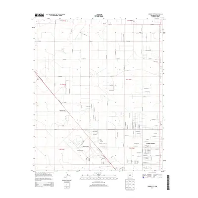
2013 Map of Humble City
USGS Topo · Published 2013About this map
Humble City and its surroundings in Lea County reflect the steady northward expansion of the Permian Basin's urban and educational footprint. The landscape is marked by the transition from rural cattle country to an institutional and industrial hub, anchored by the presence of the Univ of the Southwest and New Mexico Jr Coll. At the center of the survey, the intersection of N Lovington Hwy and W Kansas St defines the local transport grid, connecting the residential neighborhoods of North Hobbs to specialized zones like the Industrial Airpark and Air Base City. This layout reveals how mid-century military infrastructure has been repurposed for modern industry and aviation. Further north, the settlement of Knowles retains its character with a local Cem, serving as a reminder of the earlier ranching era before the modern development of Texas St and the surrounding street network.
Find a feature on this map
157 named features on this map. Tap any name to fly to it.
Don’t see what you’re looking for? This feature index may not catch every label — zoom into the map to look around manually.
Map Details
Editions of this 2013 Humble City Map
This is the sole edition of this map. No revisions or reprints were ever made.
Other maps of this area

1954 · Hobbs
USGS Topo · 1:250,000

1958 · Hobbs
USGS Topo · 1:250,000

1962 · Lovington
USGS Topo · 1:24,000

1962 · Lovington
USGS Topo · 1:62,500

1963 · Monument
USGS Topo · 1:62,500

1969 · Humble City
USGS Topo · 1:24,000

1969 · Hobbs East
USGS Topo · 1:24,000

1969 · Humble City NE
USGS Topo · 1:24,000

1969 · Hobbs West
USGS Topo · 1:24,000

1969 · Humble City SE
USGS Topo · 1:24,000