
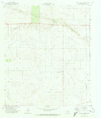
1969 Map of Humble City SE
USGS Topo · Published 1972About this map
Johnson Draw and Seminole Draw carve subtle paths across this arid landscape, which straddles the New Mexico and Texas border along the line between Lea and Gaines counties. The area is defined by the heavy infrastructure of the petroleum industry during the late 1960s, with a dense network of Oil Wells and subsurface Pipelines extending across the high plains. Unlike more settled regions, this terrain is marked by industrial utility rather than town centers, featuring scattered Drill Holes and a Radio Tower that served as a navigational landmark in the open territory. For those researching the industrial history of the Permian Basin, the map offers an exact record of mid-century oil exploration and the infrastructure required to support it before the landscape was further altered by modern development.
Find a feature on this map
10 named features on this map. Tap any name to fly to it.
Don’t see what you’re looking for? This feature index may not catch every label — zoom into the map to look around manually.
Map Details
Editions of this 1969 Humble City SE Map
This is the sole edition of this map. No revisions or reprints were ever made.
Other maps of this area

1954 · Hobbs
USGS Topo · 1:250,000

1958 · Hobbs
USGS Topo · 1:250,000

1969 · Humble City
USGS Topo · 1:24,000

1969 · Hobbs East
USGS Topo · 1:24,000

1969 · Humble City NE
USGS Topo · 1:24,000

1969 · Hobbs West
USGS Topo · 1:24,000

1970 · Humble City SE
USGS Topo · 1:24,000

1971 · Higginbotham
USGS Topo · 1:24,000

1971 · Denver City SW
USGS Topo · 1:24,000
1971 · Paynes Corner NW
USGS Topo · 1:24,000