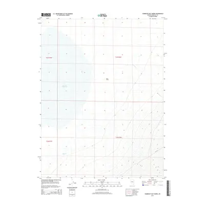
2014 Map of Humboldt Salt Marsh
USGS Topo · Published 2014About this map
Humboldt Salt Marsh dominates the western half of this Churchill County basin, illustrating the endorheic drainage patterns typical of the Great Basin region. This 2014 survey captures the stark transition from the alkali flats of the marsh to the rising slopes of the Stillwater Range, where features like Hoyt Cyn and Bernice Cr define the eastern topography. The central floor is occupied by Dixie Valley, a region noted for its tectonic activity and geothermal potential. Small water sources like Buckbrush Spring on the western edge represent critical historical landmarks for survival in this arid environment. The map provides a precise layout of the Public Land Survey System, including the junction of t23n r36e and t22n r36e, which is essential for land title research and local history mapping.
Find a feature on this map
9 named features on this map. Tap any name to fly to it.
Don’t see what you’re looking for? This feature index may not catch every label — zoom into the map to look around manually.
Map Details
Editions of this 2014 Humboldt Salt Marsh Map
This is the sole edition of this map. No revisions or reprints were ever made.
Other maps of this area

1908 · Carson Sink
USGS Topo · 1:250,000

1910 · Carson Sink
USGS Topo · 1:250,000

1955 · Millett
USGS Topo · 1:250,000

1957 · Reno
USGS Topo · 1:250,000

1959 · Reno
USGS Topo · 1:250,000

1959 · Millett
USGS Topo · 1:250,000

1960 · Reno
USGS Topo · 1:250,000

1966 · Clan Alpine Ranch
USGS Topo · 1:62,500

1966 · Humboldt Salt Marsh
USGS Topo · 1:62,500

1966 · Dixie Hot Springs
USGS Topo · 1:62,500