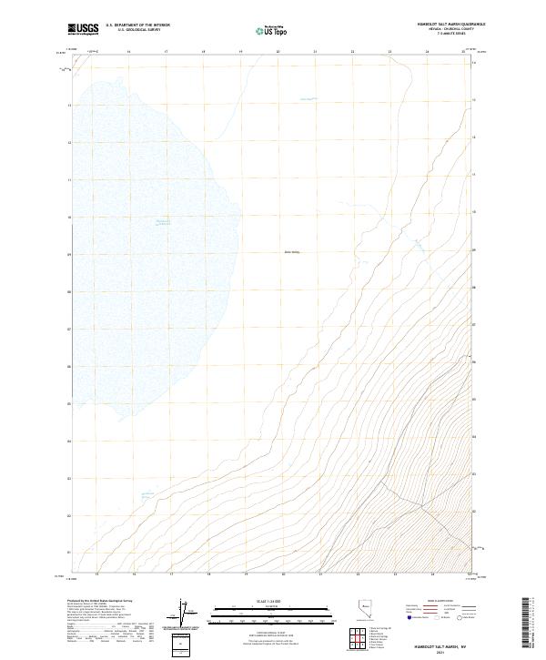
2021 Map of Humboldt Salt Marsh
USGS Topo · Published 2021About this map
Humboldt Salt Marsh dominates this portion of the Dixie Valley, where the hydrological patterns of Churchill County are clearly defined by the vast white expanse of the alkali flat. The map depicts a landscape where water is the primary architect of the terrain, though it is often ephemeral or subterranean. Toward the north, Dixie Meadows provides a distinct contrast to the salt-crusted basin, marking an area where subsurface moisture supports a localized ecosystem. The eastern edge of the quadrangle is defined by the alluvial fans descending toward the valley floor, cut by drainage features like Bernice Cr. To the southwest, Buckbrush Spring serves as a critical water source in an otherwise arid environment, typical of the Great Basin's basin-and-range topography. This map illustrates the intersection of Public Land Survey System boundaries, such as t23n r36e, across a floor where seasonal runoff and evaporation cycles dictate the land's character.
Find a feature on this map
9 named features on this map. Tap any name to fly to it.
Don’t see what you’re looking for? This feature index may not catch every label — zoom into the map to look around manually.
Map Details
Editions of this 2021 Humboldt Salt Marsh Map
This is the sole edition of this map. No revisions or reprints were ever made.
Other maps of this area

1908 · Carson Sink
USGS Topo · 1:250,000

1910 · Carson Sink
USGS Topo · 1:250,000

1955 · Millett
USGS Topo · 1:250,000

1957 · Reno
USGS Topo · 1:250,000

1959 · Reno
USGS Topo · 1:250,000

1959 · Millett
USGS Topo · 1:250,000

1960 · Reno
USGS Topo · 1:250,000

1966 · Clan Alpine Ranch
USGS Topo · 1:62,500

1966 · Humboldt Salt Marsh
USGS Topo · 1:62,500

1966 · Dixie Hot Springs
USGS Topo · 1:62,500