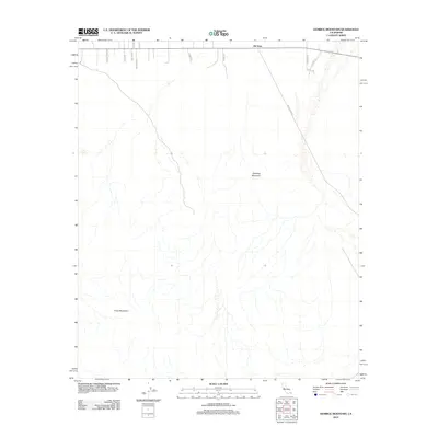
2012 Map of Humbug Mountain
USGS Topo · Published 2012About this map
Old Dale sits at the northern edge of this high desert landscape, serving as a focal point for a network of rural roads that stretch into the surrounding wilderness. The terrain is defined by the significant elevations of Humbug Mountain and the northeastern reaches of the Pinto Mountains, where the dry drainage patterns illustrate the complex alluvial fan systems of the San Bernardino County desert. Historically significant routes like Gold Crown Rd and Misty Trl wind through the topography, reflecting a legacy of desert transit and land use. This 2012 survey by the U.S. Geological Survey details the sparse but deliberate human footprint in a region dominated by rugged peaks and vast, open basins.
Find a feature on this map
15 named features on this map. Tap any name to fly to it.
Don’t see what you’re looking for? This feature index may not catch every label — zoom into the map to look around manually.
Map Details
Editions of this 2012 Humbug Mountain Map
This is the sole edition of this map. No revisions or reprints were ever made.
Other maps of this area

1942 · Amboy
USGS Topo · 1:250,000

1943 · Amboy
USGS Topo · 1:250,000

1943 · Pinkham Well
USGS Topo · 1:62,500

1944 · Pinkham Well
USGS Topo · 1:62,500

1944 · Eagle Tank
USGS Topo · 1:62,500

1954 · Salton Sea
USGS Topo · 1:250,000

1954 · Needles
USGS Topo · 1:250,000

1954 · Valley Mtn
USGS Topo · 1:24,000

1955 · Salton Sea
USGS Topo · 1:250,000

1956 · Needles
USGS Topo · 1:250,000