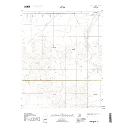
2018 Map of Humbug Mountain
USGS Topo · Published 2018About this map
Old Dale sits at the northern edge of this arid expanse, where the high Mojave Desert meets the rugged slopes of Humbug Mtn. This terrain is defined by its mining history and remote access, with names like Goods Mine Rd and Gold Crown Rd tracing the legacy of mineral exploration across the San Bernardino and Riverside county lines. The southern portion of the map is dominated by the Pinto Mountains, a stark landscape where the elevation rises significantly from the desert floor. A network of local roads including Sand Canyon Dr, Bonnie Dunes Rd, and Morning Star Rd provides the primary infrastructure through the northern flats. This survey documents the persistent presence of these desert tracks and the topographical complexity of the southern peaks in the modern era.
Find a feature on this map
18 named features on this map. Tap any name to fly to it.
Don’t see what you’re looking for? This feature index may not catch every label — zoom into the map to look around manually.
Map Details
Editions of this 2018 Humbug Mountain Map
This is the sole edition of this map. No revisions or reprints were ever made.
Other maps of this area

1942 · Amboy
USGS Topo · 1:250,000

1943 · Amboy
USGS Topo · 1:250,000

1943 · Pinkham Well
USGS Topo · 1:62,500

1944 · Pinkham Well
USGS Topo · 1:62,500

1944 · Eagle Tank
USGS Topo · 1:62,500

1954 · Salton Sea
USGS Topo · 1:250,000

1954 · Needles
USGS Topo · 1:250,000

1954 · Valley Mtn
USGS Topo · 1:24,000

1955 · Salton Sea
USGS Topo · 1:250,000

1956 · Needles
USGS Topo · 1:250,000