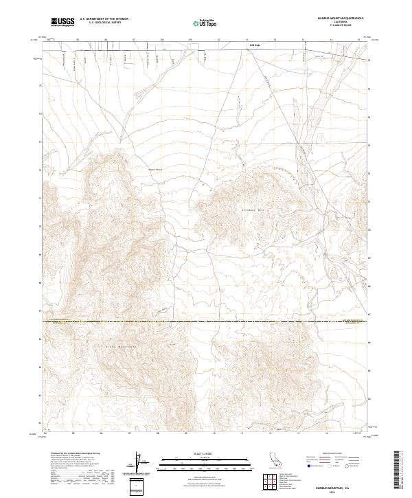
2021 Map of Humbug Mountain
USGS Topo · Published 2021About this map
Old Dale and the high desert terrain of the Pinto Mountains define this section of the Mojave Desert along the border of San Bernardino and Riverside Counties. The landscape is etched with the remnants of industrial passage, particularly through names like Gold Crown Rd and Goods Mine Rd, which hint at the region's historical mining activity. While the northern reaches show a sparse grid of residential desert tracks such as Comet Rd and Morning Star Rd, the center is dominated by the prominent rise of Humbug Mtn. This 2021 survey illustrates the persistent isolation of this arid corridor, where modern desert living meets the rugged footprint of early 20th-century prospecting and trail-building, as seen at Misty Trl.
Find a feature on this map
24 named features on this map. Tap any name to fly to it.
Don’t see what you’re looking for? This feature index may not catch every label — zoom into the map to look around manually.
Map Details
Editions of this 2021 Humbug Mountain Map
This is the sole edition of this map. No revisions or reprints were ever made.
Other maps of this area

1942 · Amboy
USGS Topo · 1:250,000

1943 · Amboy
USGS Topo · 1:250,000

1943 · Pinkham Well
USGS Topo · 1:62,500

1944 · Pinkham Well
USGS Topo · 1:62,500

1944 · Eagle Tank
USGS Topo · 1:62,500

1954 · Salton Sea
USGS Topo · 1:250,000

1954 · Needles
USGS Topo · 1:250,000

1954 · Valley Mtn
USGS Topo · 1:24,000

1955 · Salton Sea
USGS Topo · 1:250,000

1956 · Needles
USGS Topo · 1:250,000