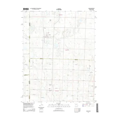
2014 Map of Hume
USGS Topo · Published 2014About this map
The town of Hume sits at the intersection of local history and state geography, positioned along the Kansas Missouri border. This survey details a landscape defined by small rural settlements and an intricate network of country roads, including E Aaron Rd and E Chouteau Rd. Genealogists and local historians can locate several burial grounds scattered across the countryside, such as Hume Cemetery, Lawrence Cemetery, Underwood Cemetery, and Clark Cemetery. The terrain is characterized by watercourses like Walnut Cr and Duncan Cr, which drain the area surrounding the small communities of Amos and Rock. A notable geographic landmark, Rocky Mound, rises above the northern reaches of the quadrangle, providing a distinct focal point in an area otherwise dominated by agriculture and the small-town life typical of the region's western edge.
Find a feature on this map
49 named features on this map. Tap any name to fly to it.
Don’t see what you’re looking for? This feature index may not catch every label — zoom into the map to look around manually.
Map Details
Editions of this 2014 Hume Map
This is the sole edition of this map. No revisions or reprints were ever made.
Other maps of this area

1884 · Fort Scott
USGS Topo · 1:125,000

1886 · Nevada
USGS Topo · 1:125,000

1886 · Fort Scott
USGS Topo · 1:125,000

1887 · Butler
USGS Topo · 1:125,000

1887 · Mound City
USGS Topo · 1:125,000

1893 · Fort Scott
USGS Topo · 1:125,000

1893 · Mound City
USGS Topo · 1:125,000

1894 · Butler
USGS Topo · 1:125,000

1894 · Nevada
USGS Topo · 1:125,000

1937 · New Home
USGS Topo · 1:24,000