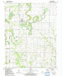
1991 Map of Hume
USGS Topo · Published 1991About this map
The borderlands of Missouri and Kansas center on the town of Hume, a settlement established in the late 19th century that serves as the primary hub for this agricultural region. This 1991 publication, based on late-1980s field checks, reveals the complex political boundaries where the state line and county markers for Linn and Bates counties intersect. The landscape is defined by a dense network of watercourses, including the meandering Walnut Creek in the north and the West Fork Pryor Creek to the east, while Rocky Mound provides a rare point of elevation.
Find a feature on this map
23 named features on this map. Tap any name to fly to it.
Don’t see what you’re looking for? This feature index may not catch every label — zoom into the map to look around manually.
Map Details
Editions of this 1991 Hume Map
This is the sole edition of this map. No revisions or reprints were ever made.
Other maps of this area

1884 · Fort Scott
USGS Topo · 1:125,000

1886 · Nevada
USGS Topo · 1:125,000

1886 · Fort Scott
USGS Topo · 1:125,000

1887 · Butler
USGS Topo · 1:125,000

1887 · Mound City
USGS Topo · 1:125,000

1893 · Fort Scott
USGS Topo · 1:125,000

1893 · Mound City
USGS Topo · 1:125,000

1894 · Butler
USGS Topo · 1:125,000

1894 · Nevada
USGS Topo · 1:125,000

1937 · New Home
USGS Topo · 1:24,000