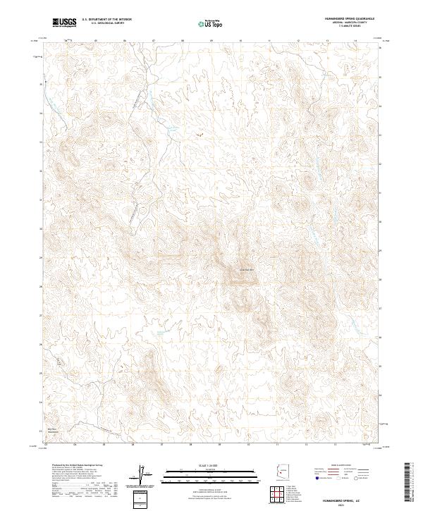
2021 Map of Hummingbird Spring
USGS Topo · Published 2021About this map
The northern foothills of the Big Horn Mountains define this arid landscape in western Maricopa County. This terrain is characterized by a series of intermittent drainages, most notably Old Camp Wash and Coyote Wash, which carve through the desert floor. In a region where surface water is scarce, specific landmarks like Hummingbird Spring and Dead Horse Tank represent critical water sources for local wildlife and travelers. The prominence of Sugarloaf Mtn serves as a primary navigational waypoint for the surrounding area.
Find a feature on this map
19 named features on this map. Tap any name to fly to it.
Don’t see what you’re looking for? This feature index may not catch every label — zoom into the map to look around manually.
Map Details
Editions of this 2021 Hummingbird Spring Map
This is the sole edition of this map. No revisions or reprints were ever made.
Other maps of this area

1942 · Vicksburg
USGS Topo · 1:250,000

1954 · Phoenix
USGS Topo · 1:250,000

1957 · Phoenix
USGS Topo · 1:250,000

1958 · Phoenix
USGS Topo · 1:250,000

1960 · Phoenix
USGS Topo · 1:250,000

1961 · Vulture Mountains
USGS Topo · 1:62,500

1961 · Big Horn Mts
USGS Topo · 1:62,500

1962 · Belmont Mts
USGS Topo · 1:62,500
1962 · Aguila
USGS Topo · 1:62,500

1969 · Phoenix
USGS Topo · 1:250,000