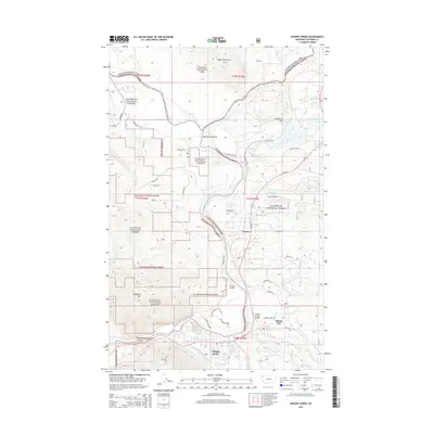
2014 Map of Hungry Horse
USGS Topo · Published 2014About this map
Martin City and the neighboring community of Hungry Horse sit at the gateway to some of Montana’s most protected wilderness, positioned where the South Fork Flathead River joins the main stem. This 2014 survey illustrates the complex boundary where Glacier National Park meets the Flathead National Forest, a landscape defined by sharp elevation shifts and river crossings. The map details the transit corridor along Us HWY 2, connecting the small settlements of Coram and Martin City to the rugged interior. Significant local landmarks such as Blankenship Bridge and the Coram Bridge mark the essential crossing points over the winding Flathead River. To the west, the steep ascent of Teakettle Mtn and the narrow passage of Badrock Canyon frame the valley, while the northern reaches of the sheet are dominated by the Apgar Mountains.
Find a feature on this map
46 named features on this map. Tap any name to fly to it.
Don’t see what you’re looking for? This feature index may not catch every label — zoom into the map to look around manually.
Map Details
Editions of this 2014 Hungry Horse Map
This is the sole edition of this map. No revisions or reprints were ever made.
Other maps of this area

1904 · Chief Mountain
USGS Topo · 1:125,000

1906 · Kintla Lakes
USGS Topo · 1:125,000

1914 · Nyack
USGS Topo · 1:125,000

1938 · Chief Mountain
USGS Topo · 1:125,000

1938 · Kintla Lakes
USGS Topo · 1:125,000

1943 · Kalispell
USGS Topo · 1:125,000

1957 · Kalispell
USGS Topo · 1:250,000

1960 · Kalispell
USGS Topo · 1:250,000

1960 · Cut Bank
USGS Topo · 1:250,000

1961 · Kalispell
USGS Topo · 1:250,000