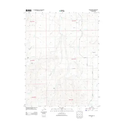
2013 Map of Hunter Mesa
USGS Topo · Published 2013About this map
Hunter Mesa and the surrounding high country of Garfield County are defined by a complex network of agricultural irrigation, as seen in this 2013 survey. The landscape is etched with vital water infrastructure, including the Multa Trina Ditch, Highline Ditch, and Porter Ditch, which divert water from the various branches of Mamm Creek to support the area's ranching operations. These engineered waterways contrast with the natural drainage patterns of Dry Hollow Creek and Alkali Creek, illustrating the long-standing human effort to manage water in the arid Colorado West.
Find a feature on this map
28 named features on this map. Tap any name to fly to it.
Don’t see what you’re looking for? This feature index may not catch every label — zoom into the map to look around manually.
Map Details
Editions of this 2013 Hunter Mesa Map
This is the sole edition of this map. No revisions or reprints were ever made.
Other maps of this area

1906 · Grand Hogback
USGS Topo · 1:125,000

1910 · Grand Hogback
USGS Topo · 1:125,000

1952 · Rifle
USGS Topo · 1:24,000

1957 · Leadville
USGS Topo · 1:250,000

1959 · Leadville
USGS Topo · 1:250,000

1960 · Leadville
USGS Topo · 1:250,000

1960 · North Mamm Peak
USGS Topo · 1:24,000

1960 · South Mamm Peak
USGS Topo · 1:24,000

1962 · Leadville
USGS Topo · 1:250,000

1962 · New Castle
USGS Topo · 1:24,000