
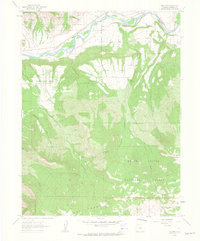
1960 Map of North Mamm Peak
USGS Topo · Published 1964About this map
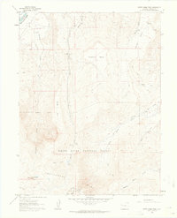
Battlement Mesa and the surrounding high-plateau country define this landscape in the early 1960s, a period when energy exploration began to mark the Garfield County wilderness. Multiple gas and oil wells are situated near the Colorado River in the northwest, while a network of pack and jeep trails provides the only access to the steep drainage systems of West Mamm Creek and Middle Mamm Creek. The map documents a significant intersection of public lands, showing the White River National Forest and Grand Mesa Nat Forest meeting near the prominent summit of North Mamm Peak. Researchers will find evidence of the region's hydrography and resource management, from the Gaging Sta on Beaver Creek to several high-altitude springs and the open meadow of Tepee Park, which offered key landmarks for early surveyors and ranchmen in this upland terrain.
Find a feature on this map
28 named features on this map. Tap any name to fly to it.
Don’t see what you’re looking for? This feature index may not catch every label — zoom into the map to look around manually.
Map Details
Editions of this 1960 North Mamm Peak Map
4 editions found
Other maps of this area

1906 · Grand Hogback
USGS Topo · 1:125,000

1910 · Grand Hogback
USGS Topo · 1:125,000

1952 · Anvil Points
USGS Topo · 1:24,000

1952 · Rifle
USGS Topo · 1:24,000

1957 · Leadville
USGS Topo · 1:250,000

1959 · Leadville
USGS Topo · 1:250,000

1960 · Leadville
USGS Topo · 1:250,000
1960 · Hawxhurst Creek
USGS Topo · 1:24,000

1960 · South Mamm Peak
USGS Topo · 1:24,000
1960 · Rulison
USGS Topo · 1:24,000