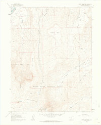
1960 Map of North Mamm Peak
USGS Topo · Published 1964About this map
Battlement Mesa and the high peaks of the Colorado backcountry define this 1960s survey, capturing a rugged landscape before modern development altered its primitive access. The northern boundary is marked by the Colorado River, while the interior is dominated by a complex network of high plateaus including Flatiron Mesa, Log Mesa, and the expansive Grass Mesa. These heights are dissected by numerous drainage systems such as Beaver Creek and Porcupine Creek, which descend toward the river valley.
Find a feature on this map
24 named features on this map. Tap any name to fly to it.
Don’t see what you’re looking for? This feature index may not catch every label — zoom into the map to look around manually.
Map Details
Editions of this 1960 North Mamm Peak Map
4 editions found
Other maps of this area

1906 · Grand Hogback
USGS Topo · 1:125,000

1910 · Grand Hogback
USGS Topo · 1:125,000

1952 · Anvil Points
USGS Topo · 1:24,000

1952 · Rifle
USGS Topo · 1:24,000

1957 · Leadville
USGS Topo · 1:250,000

1959 · Leadville
USGS Topo · 1:250,000

1960 · Leadville
USGS Topo · 1:250,000

1960 · North Mamm Peak
USGS Topo · 1:24,000
1960 · Hawxhurst Creek
USGS Topo · 1:24,000

1960 · South Mamm Peak
USGS Topo · 1:24,000