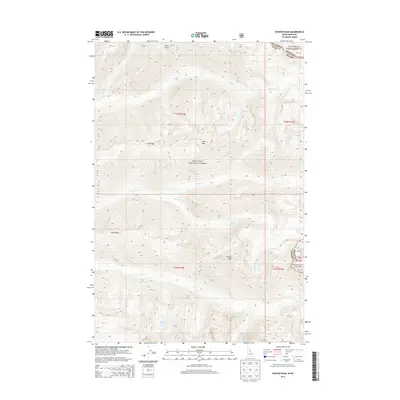
2013 Map of Hunter Peak
USGS Topo · Published 2013About this map
Hunter Peak dominates the southern landscape of this high-elevation region along the border of Ravalli County and Idaho. The terrain is defined by its dramatic watershed divides, where Elk Ridge and Long Ridge separate the drainage basins of Bear Cr and Spruce Cr. This 2013 survey illustrates a landscape primarily managed within the Bitterroot National Forest and Nez Perce National Forest, showing the intricate network of high-mountain lakes and seasonal streams. Small, isolated bodies of water such as Moe Lake, Diamond Lake, and Bigfoot Lake are tucked into glacial cirques and high basins, accessible only by the primitive paths and forest service roads that wind through the timber. The map also records the precise political boundary between Montana and Idaho, marking a point where the continental geography is as much about elevation as it is about state lines.
Find a feature on this map
26 named features on this map. Tap any name to fly to it.
Don’t see what you’re looking for? This feature index may not catch every label — zoom into the map to look around manually.
Map Details
Editions of this 2013 Hunter Peak Map
This is the sole edition of this map. No revisions or reprints were ever made.
Other maps of this area

1901 · Hamilton
USGS Topo · 1:125,000

1911 · Lolo
USGS Topo · 1:250,000

1913 · Lolo
USGS Topo · 1:250,000

1956 · Elk City
USGS Topo · 1:250,000

1956 · Hamilton
USGS Topo · 1:250,000

1959 · Hamilton
USGS Topo · 1:250,000

1960 · Elk City
USGS Topo · 1:250,000

1960 · Hamilton
USGS Topo · 1:250,000

1964 · Hamilton
USGS Topo · 1:250,000

1964 · Tenmile Lake
USGS Topo · 1:24,000