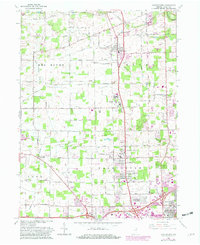
1963 Map of Huntertown
USGS Topo · Published 1982About this map
Huntertown sits at the intersection of a developing suburban landscape and the agricultural tradition of northern Allen County. This 1960s survey captures the region just as the northern reaches of Fort Wayne began to expand toward Ludwig Park, yet it retains many hallmarks of an earlier era. The Treaty Boundary line cuts diagonally across the center of the sheet, providing a visible link to the historical territorial divisions of Indiana.
Find a feature on this map
48 named features on this map. Tap any name to fly to it.
Don’t see what you’re looking for? This feature index may not catch every label — zoom into the map to look around manually.
Map Details
Editions of this 1963 Huntertown Map
Other maps of this area

1953 · Fort Wayne
USGS Topo · 1:250,000

1955 · Ege
USGS Topo · 1:24,000

1956 · Fort Wayne
USGS Topo · 1:250,000

1956 · Fort Wayne West
USGS Topo · 1:24,000

1956 · Fort Wayne East
USGS Topo · 1:24,000

1956 · Cedarville
USGS Topo · 1:24,000

1957 · Auburn
USGS Topo · 1:24,000

1957 · Huntertown
USGS Topo · 1:24,000

1957 · Garrett
USGS Topo · 1:24,000

1957 · Churubusco
USGS Topo · 1:24,000