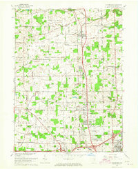
1963 Map of Huntertown
USGS Topo · Published 1965About this map
The Eel River and its various tributaries, including Willow Creek and Spy Run, define the drainage of this rural landscape north of Fort Wayne. At the time of this 1963 revision, the area maintained a distinct agricultural character interspersed with specialized institutions like the Byron Sanatorium, the County Home, and the County Childrens Home. The small settlement of Huntertown serves as a local hub along the Pennsylvania railroad line, while the northern fringes of the city begin to emerge at Ludwig Park and the Fort Wayne Municipal Airport (Smith Field). Local history is preserved through several family and community landmarks, such as Duhn Mill, Bethel Cem, and the Huntertown Cemeteries, reflecting a well-established pattern of mid-century Midwestern settlement prior to the expansion of the interstate system through Allen County.
Find a feature on this map
54 named features on this map. Tap any name to fly to it.
Don’t see what you’re looking for? This feature index may not catch every label — zoom into the map to look around manually.
Map Details
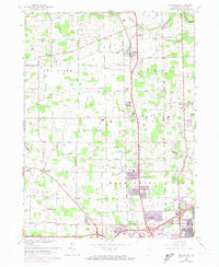
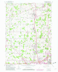
Editions of this 1963 Huntertown Map
Other maps of this area

1953 · Fort Wayne
USGS Topo · 1:250,000

1955 · Ege
USGS Topo · 1:24,000

1956 · Fort Wayne
USGS Topo · 1:250,000

1956 · Fort Wayne West
USGS Topo · 1:24,000

1956 · Fort Wayne East
USGS Topo · 1:24,000

1956 · Cedarville
USGS Topo · 1:24,000

1957 · Auburn
USGS Topo · 1:24,000

1957 · Huntertown
USGS Topo · 1:24,000

1957 · Garrett
USGS Topo · 1:24,000

1957 · Churubusco
USGS Topo · 1:24,000