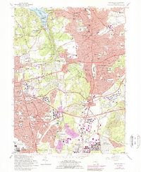
1967 Map of Huntington
USGS Topo · Published 1989About this map
Huntington and Huntington Station anchor this detailed mid-century view of the Long Island landscape as suburban expansion began to overlay the older harbor-front and hilltop settlements. To the north, the shorelines of Cold Spring Harbor and the Inner Harbor remain defined by features like the Carnegie Institute and Cold Spring Bar, while the interior shows the rising density of residential development between the Mannetto Hills and West Hills. The map serves as a vital record for genealogists and local historians, capturing numerous civic landmarks before modern redevelopment, including the Walt Whitman Birthplace and the sprawling grounds of the Suffolk State School.
Find a feature on this map
89 named features on this map. Tap any name to fly to it.
Don’t see what you’re looking for? This feature index may not catch every label — zoom into the map to look around manually.
Map Details
Editions of this 1967 Huntington Map
2 editions found
Other maps of this area

1897 · Hempstead
USGS Topo · 1:62,500

1897 · Oyster Bay
USGS Topo · 1:62,500

1898 · Hempstead
USGS Topo · 1:62,500

1898 · Oyster Bay
USGS Topo · 1:62,500

1899 · Hempstead
USGS Topo · 1:62,500

1900 · Oyster Bay
USGS Topo · 1:62,500

1901 · Babylon
USGS Topo · 1:62,500

1901 · Northport
USGS Topo · 1:62,500

1903 · Babylon
USGS Topo · 1:62,500

1903 · Northport
USGS Topo · 1:62,500