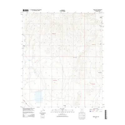
2013 Map of Hurley East
USGS Topo · Published 2013About this map
Hurley sits on the western edge of this High Desert landscape, where the industrial and natural geography of Grant County meet. A dominant feature of the local water management system is the Whitewater Reservoir, which collects drainage from the surrounding high ground to support regional needs. The terrain is defined by a series of significant erosional features including Martin Canyon, Rustler Canyon, and Seneca Canyon, which cut through the arid uplands. Whitewater Cr and Lampbright Draw serve as the primary hydrologic arteries, channeling seasonal runoff toward the south. This 2013 survey illustrates the modern configuration of the land, showing how the transportation corridor of Us-180 E provides essential access to this mining-adjacent region while skirting the intricate drainage networks that characterize the eastern outskirts of the settlement.
Find a feature on this map
13 named features on this map. Tap any name to fly to it.
Don’t see what you’re looking for? This feature index may not catch every label — zoom into the map to look around manually.
Map Details
Editions of this 2013 Hurley East Map
This is the sole edition of this map. No revisions or reprints were ever made.
Other maps of this area

1909 · Silver City
USGS Topo · 1:125,000

1937 · Santa Rita
USGS Topo · 1:24,000

1947 · Faywood Station
USGS Topo · 1:24,000

1947 · Fort Bayard
USGS Topo · 1:24,000

1948 · Santa Rita
USGS Topo · 1:24,000

1948 · Hurley East
USGS Topo · 1:24,000

1949 · Fort Bayard
USGS Topo · 1:24,000

1949 · Whitewater
USGS Topo · 1:24,000

1949 · Hurley East
USGS Topo · 1:24,000

1949 · Faywood Station
USGS Topo · 1:24,000