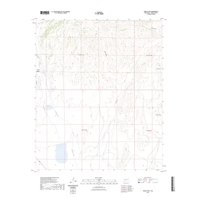
2023 Map of Hurley East
USGS Topo · Published 2023About this map
North Hurley sits at the western edge of this Grant County landscape, where the high desert terrain begins its descent toward the drainage basins of the Gila National Forest region. The map is defined by a series of prominent topographical depressions including Rustler Canyon and Martin Canyon in the north, while the winding course of Whitewater Creek cuts through the western sections. The eastern half of the quadrangle is marked by the expansive Lampbright Draw and the deep cuts of Seneca Canyon. These features illustrate the complex hydrology of the area, showing how seasonal runoff has carved the landscape between various township and range boundaries. Local transit is represented by Delancey Rd and Chino Blvd, which serve the small settlement and adjacent industrial or agricultural tracts.
Find a feature on this map
13 named features on this map. Tap any name to fly to it.
Don’t see what you’re looking for? This feature index may not catch every label — zoom into the map to look around manually.
Map Details
Editions of this 2023 Hurley East Map
This is the sole edition of this map. No revisions or reprints were ever made.
Other maps of this area

1909 · Silver City
USGS Topo · 1:125,000

1937 · Santa Rita
USGS Topo · 1:24,000

1947 · Faywood Station
USGS Topo · 1:24,000

1947 · Fort Bayard
USGS Topo · 1:24,000

1948 · Santa Rita
USGS Topo · 1:24,000

1948 · Hurley East
USGS Topo · 1:24,000

1949 · Fort Bayard
USGS Topo · 1:24,000

1949 · Whitewater
USGS Topo · 1:24,000

1949 · Hurley East
USGS Topo · 1:24,000

1949 · Faywood Station
USGS Topo · 1:24,000