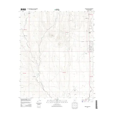
2013 Map of Hurley West
USGS Topo · Published 2013About this map
Hurley stands as a central hub in this high-desert landscape of southwestern New Mexico, defined by its grid of residential streets like Cortez Ave and Santa Rita Ave. To the north and west, the terrain rises toward Lone Mtn, where the land is carved by natural drainages including the Rio de Arenas and Cameron Cr. The presence of the Grant County Airport in the south and the Hurley Cem near the town center provides a clear view of the infrastructure supporting these copper-belt communities. Historic transportation and utility corridors, such as the Gas Line and various named routes like Rosedale Rd, highlight the connectivity between the settlements of North Hurley, Bayard, and the outlying area of Rosedale. The drainage patterns of San Vicente Arroyo and Pipe Line Draw illustrate the complex hydrology typical of this arid region.
Find a feature on this map
52 named features on this map. Tap any name to fly to it.
Don’t see what you’re looking for? This feature index may not catch every label — zoom into the map to look around manually.
Map Details
Editions of this 2013 Hurley West Map
This is the sole edition of this map. No revisions or reprints were ever made.
Other maps of this area

1909 · Silver City
USGS Topo · 1:125,000

1937 · Santa Rita
USGS Topo · 1:24,000

1947 · Faywood Station
USGS Topo · 1:24,000

1947 · Fort Bayard
USGS Topo · 1:24,000

1948 · Santa Rita
USGS Topo · 1:24,000

1948 · Hurley East
USGS Topo · 1:24,000

1949 · Fort Bayard
USGS Topo · 1:24,000

1949 · Whitewater
USGS Topo · 1:24,000

1949 · Hurley East
USGS Topo · 1:24,000

1949 · Faywood Station
USGS Topo · 1:24,000