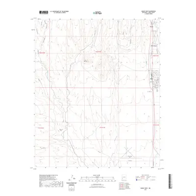
2023 Map of Hurley West
USGS Topo · Published 2023About this map
Hurley and its neighboring settlements define the eastern edge of this Grant County landscape, where the high desert meets a complex network of drainage arroyos. The map illustrates a clear transition from the industrial and residential grid of the town site—complete with street names like Aztec Ave and Diaz Ave—to the open, rolling terrain dominated by Lone Mountain. Three distinct burial sites, including the Old Hurley Cem and Bayard Cem, provide essential data for genealogists tracing early families in the region.
Find a feature on this map
48 named features on this map. Tap any name to fly to it.
Don’t see what you’re looking for? This feature index may not catch every label — zoom into the map to look around manually.
Map Details
Editions of this 2023 Hurley West Map
This is the sole edition of this map. No revisions or reprints were ever made.
Other maps of this area

1909 · Silver City
USGS Topo · 1:125,000

1937 · Santa Rita
USGS Topo · 1:24,000

1947 · Faywood Station
USGS Topo · 1:24,000

1947 · Fort Bayard
USGS Topo · 1:24,000

1948 · Santa Rita
USGS Topo · 1:24,000

1948 · Hurley East
USGS Topo · 1:24,000

1949 · Fort Bayard
USGS Topo · 1:24,000

1949 · Whitewater
USGS Topo · 1:24,000

1949 · Hurley East
USGS Topo · 1:24,000

1949 · Faywood Station
USGS Topo · 1:24,000