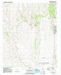
1992 Map of Hurley West
USGS Topo · Published 1992About this map
Lone Mountain stands as a central geographic anchor in this Grant County landscape, surrounded by an intricate network of desert drainages including Rio de Arenas and San Vicente Arroyo. The industrial and transportation character of the early 1990s is visible in the southeastern quadrant, where Hurley and North Hurley are situated near the At&SF rail line and a prominent aqueduct.
Find a feature on this map
26 named features on this map. Tap any name to fly to it.
Don’t see what you’re looking for? This feature index may not catch every label — zoom into the map to look around manually.
Map Details
Editions of this 1992 Hurley West Map
This is the sole edition of this map. No revisions or reprints were ever made.
Other maps of this area

1909 · Silver City
USGS Topo · 1:125,000

1937 · Santa Rita
USGS Topo · 1:24,000

1947 · Faywood Station
USGS Topo · 1:24,000

1947 · Fort Bayard
USGS Topo · 1:24,000

1948 · Santa Rita
USGS Topo · 1:24,000

1948 · Hurley East
USGS Topo · 1:24,000

1949 · Fort Bayard
USGS Topo · 1:24,000

1949 · Whitewater
USGS Topo · 1:24,000

1949 · Hurley East
USGS Topo · 1:24,000

1949 · Faywood Station
USGS Topo · 1:24,000