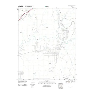
2011 Map of Hurricane
USGS Topo · Published 2011About this map
Hurricane and La Verkin sit at a vital geographical junction where Ash Creek and La Verkin Creek join the Virgin River. This 2011 survey captures the residential expansion across the Hurricane Fields and the importance of water management in this arid region, evidenced by the Frog Hollow Debris Basin Dam. Mining history is preserved in the northern reaches of the quadrangle through features like the Vanderbilt Mine, Doyle Shaft, and the mineral-rich area around Buckeye Reef.
Find a feature on this map
56 named features on this map. Tap any name to fly to it.
Don’t see what you’re looking for? This feature index may not catch every label — zoom into the map to look around manually.
Map Details
Editions of this 2011 Hurricane Map
This is the sole edition of this map. No revisions or reprints were ever made.
Other maps of this area

1885 · St. George
USGS Topo · 1:250,000

1891 · St. George
USGS Topo · 1:250,000

1953 · Cedar City
USGS Topo · 1:250,000

1954 · La Verkin 4 NW
USGS Topo · 1:24,000

1954 · La Verkin 4 SW
USGS Topo · 1:24,000

1954 · La Verkin 3 NW
USGS Topo · 1:24,000

1954 · La Verkin 3 NE
USGS Topo · 1:24,000

1954 · La Verkin 1 SW
USGS Topo · 1:24,000

1954 · La Verkin 3 SE
USGS Topo · 1:24,000

1954 · La Verkin 3 SW
USGS Topo · 1:24,000