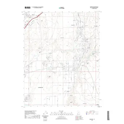
2020 Map of Hurricane
USGS Topo · Published 2020About this map
Hurricane and the surrounding river towns of Toquerville, La Verkin, and Leeds define this region of southwestern Utah, where the desert floor meets striking geologic formations. The landscape is marked by the Virgin River and the prominent Hurricane Cliffs, which create a dramatic topographical break in the terrain. For those interested in local heritage, the map identifies several early burial grounds including the Silver Reef Protestant Cem and the Silver Reef Catholic Cem, located near the historic mining-related labels of Buckeye Reef and White Reef. The area's settlement pattern follows the life-giving water of Ash Creek and the river valley, while distinctive landmarks like Mollies Nipple, Sullivan Knoll, and the Hurricane Hill overlook the growing residential blocks. Modern infrastructure is represented by General Dick Stout Field, situated on the plateau just west of the main town center.
Find a feature on this map
112 named features on this map. Tap any name to fly to it.
Don’t see what you’re looking for? This feature index may not catch every label — zoom into the map to look around manually.
Map Details
Editions of this 2020 Hurricane Map
This is the sole edition of this map. No revisions or reprints were ever made.
Other maps of this area

1885 · St. George
USGS Topo · 1:250,000

1891 · St. George
USGS Topo · 1:250,000

1953 · Cedar City
USGS Topo · 1:250,000

1954 · La Verkin 4 NW
USGS Topo · 1:24,000

1954 · La Verkin 4 SW
USGS Topo · 1:24,000

1954 · La Verkin 3 NW
USGS Topo · 1:24,000

1954 · La Verkin 3 NE
USGS Topo · 1:24,000

1954 · La Verkin 1 SW
USGS Topo · 1:24,000

1954 · La Verkin 3 SE
USGS Topo · 1:24,000

1954 · La Verkin 3 SW
USGS Topo · 1:24,000