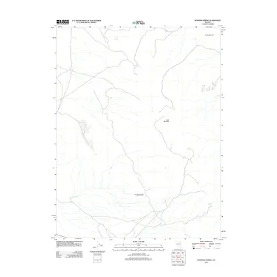
2011 Map of Hussman Spring
USGS Topo · Published 2011About this map
Hussman Spring is a focal point of this high-desert landscape in Lyon County, where the scarcity of water is evidenced by the prominent labeling of isolated water sources. This 2011 survey documents a network of primitive roads and drainage patterns between White Mountain in the northeast and Black Mountain at the center of the quadrangle. The map captures a unique landmark of the open range: the Black Mountain Dead Man Drift Fence, a feature reflecting the historical management of livestock and movement through these arid basins. Other vital water points like Perry Springs and Paiute Spring are noted along the northern edge, indicating the critical nature of these small springs for both wildlife and ranching in the Great Basin environment.
Find a feature on this map
6 named features on this map. Tap any name to fly to it.
Don’t see what you’re looking for? This feature index may not catch every label — zoom into the map to look around manually.
Map Details
Editions of this 2011 Hussman Spring Map
This is the sole edition of this map. No revisions or reprints were ever made.
Other maps of this area

1891 · Wabuska
USGS Topo · 1:125,000

1891 · Wellington
USGS Topo · 1:125,000

1893 · Wellington
USGS Topo · 1:125,000

1894 · Wabuska
USGS Topo · 1:125,000

1908 · Carson Sink
USGS Topo · 1:250,000

1909 · Hawthorne
USGS Topo · 1:250,000

1910 · Carson Sink
USGS Topo · 1:250,000

1911 · Hawthorne
USGS Topo · 1:250,000

1915 · Hawthorne
USGS Topo · 1:250,000

1948 · Walker Lake
USGS Topo · 1:250,000