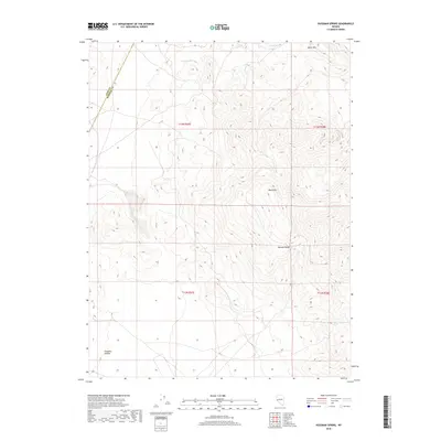
2018 Map of Hussman Spring
USGS Topo · Published 2018About this map
Hussman Spring and its namesake quadrangle cover a high-elevation landscape within the northern Wassuk Range. The terrain is defined by dramatic vertical relief, rising from Pumpkin Hollow in the southwest toward the prominent peaks of Black Mtn and White Mtn along the eastern ridge. This survey shows a remote desert environment where water sources are critical but sparse landmarks. Traditional land divisions are marked by the intersection of t13n r27e and t13n r28e, illustrating the rigid Public Land Survey System grid overlaying the irregular topography of the Great Basin. Small, named water features like Paiute Spring and Perry Springs serve as vital geographic anchors in an area otherwise characterized by vast stretches of open slope and the county line between Lyon County and Mineral County.
Find a feature on this map
12 named features on this map. Tap any name to fly to it.
Don’t see what you’re looking for? This feature index may not catch every label — zoom into the map to look around manually.
Map Details
Editions of this 2018 Hussman Spring Map
This is the sole edition of this map. No revisions or reprints were ever made.
Other maps of this area

1891 · Wabuska
USGS Topo · 1:125,000

1891 · Wellington
USGS Topo · 1:125,000

1893 · Wellington
USGS Topo · 1:125,000

1894 · Wabuska
USGS Topo · 1:125,000

1908 · Carson Sink
USGS Topo · 1:250,000

1909 · Hawthorne
USGS Topo · 1:250,000

1910 · Carson Sink
USGS Topo · 1:250,000

1911 · Hawthorne
USGS Topo · 1:250,000

1915 · Hawthorne
USGS Topo · 1:250,000

1948 · Walker Lake
USGS Topo · 1:250,000