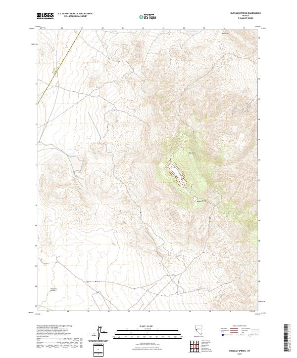
2021 Map of Hussman Spring
USGS Topo · Published 2021About this map
Hussman Spring provides a vital water source in the arid high-elevation terrain of the Wassuk Range along the boundary of Lyon and Mineral counties. This 2021 survey illustrates a landscape of significant relief, where peaks like Black Mtn and White Mtn overlook the topographical depression of Pumpkin Hollow. The area is defined by its remote springs, including Paiute Spring and Perry Springs, which historically served as essential stopovers in the Great Basin desert. The map's grid-based detail reflects the ongoing significance of the Public Land Survey System in managing this expansive Nevada terrain, tracing the intersections of several townships including t13n r27e and t12n r28e.
Find a feature on this map
12 named features on this map. Tap any name to fly to it.
Don’t see what you’re looking for? This feature index may not catch every label — zoom into the map to look around manually.
Map Details
Editions of this 2021 Hussman Spring Map
This is the sole edition of this map. No revisions or reprints were ever made.
Other maps of this area

1891 · Wabuska
USGS Topo · 1:125,000

1891 · Wellington
USGS Topo · 1:125,000

1893 · Wellington
USGS Topo · 1:125,000

1894 · Wabuska
USGS Topo · 1:125,000

1908 · Carson Sink
USGS Topo · 1:250,000

1909 · Hawthorne
USGS Topo · 1:250,000

1910 · Carson Sink
USGS Topo · 1:250,000

1911 · Hawthorne
USGS Topo · 1:250,000

1915 · Hawthorne
USGS Topo · 1:250,000

1948 · Walker Lake
USGS Topo · 1:250,000