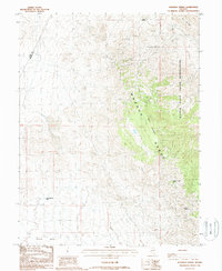
1988 Map of Hussman Spring
USGS Topo · Published 1988About this map
The Wassuk Range dominates this late-twentieth-century landscape along the border of Lyon and Mineral Counties. This high-desert terrain is marked by essential water sources like Hussman Spring and Paiute Spring, which historically supported movement through these arid slopes. The map reveals a history of extraction and industry, specifically on the eastern flanks where the Walker River Indian Reservation meets the mountains. Here, prospectors and miners left their marks at sites such as the Northern Lights Mine and an unnamed Mine Shaft further north. In the southwestern corner, the terrain transitions into the broad basin of Pumpkin Hollow, while Black Mountain stands as a prominent topographical anchor. This provisional survey provides a precise record of the trails and improved roads that connected these remote mining and grazing lands in the late 1980s.
Find a feature on this map
10 named features on this map. Tap any name to fly to it.
Don’t see what you’re looking for? This feature index may not catch every label — zoom into the map to look around manually.
Map Details
Editions of this 1988 Hussman Spring Map
This is the sole edition of this map. No revisions or reprints were ever made.
Other maps of this area

1891 · Wabuska
USGS Topo · 1:125,000

1891 · Wellington
USGS Topo · 1:125,000

1893 · Wellington
USGS Topo · 1:125,000

1894 · Wabuska
USGS Topo · 1:125,000

1908 · Carson Sink
USGS Topo · 1:250,000

1909 · Hawthorne
USGS Topo · 1:250,000

1910 · Carson Sink
USGS Topo · 1:250,000

1911 · Hawthorne
USGS Topo · 1:250,000

1915 · Hawthorne
USGS Topo · 1:250,000

1948 · Walker Lake
USGS Topo · 1:250,000