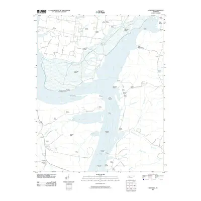
2010 Map of Hustburg
USGS Topo · Published 2010About this map
The Tennessee River and Duck River converge in this riverine landscape, where the seasonal management of the water is central to the area's geography. The Duck River Dewatering Area occupies a significant portion of the river's bend, while extensive bottomlands like Upper Big Bottom and Lower Big Bottom dictate the placement of roads and homesteads. High ground is found at Sinkhole Ridge, providing a reprieve from the frequently inundated wetlands and drains such as Clear Lake Drain.
Find a feature on this map
96 named features on this map. Tap any name to fly to it.
Don’t see what you’re looking for? This feature index may not catch every label — zoom into the map to look around manually.
Map Details
Editions of this 2010 Hustburg Map
This is the sole edition of this map. No revisions or reprints were ever made.
Other maps of this area

1936 · Hurricane Mills
USGS Topo · 1:24,000

1936 · Camden
USGS Topo · 1:24,000

1936 · Daniels Landing
USGS Topo · 1:24,000

1936 · Johnsonville
USGS Topo · 1:24,000

1936 · Sugar Tree
USGS Topo · 1:24,000

1936 · Lobelville
USGS Topo · 1:24,000

1936 · Rockport
USGS Topo · 1:24,000

1936 · Waverly
USGS Topo · 1:24,000

1936 · Hustburg
USGS Topo · 1:24,000

1949 · Daniels Landing
USGS Topo · 1:24,000