
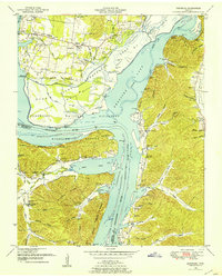
1936 Map of Rockport
USGS Topo · Published 1936About this map
Trotters Ferry and Crocketts Landing serve as critical river crossings along the Tennessee River in this 1930s survey, documenting the Benton and Humphreys County border before modern infrastructure reshaped the valley. The landscape is defined by an intricate network of waterways including Little Birdsong Creek and Eagle Creek, where small agrarian settlements like Chalklevel and Coxburg are linked by State Highway No 69. This era of rural development is reflected in the numerous educational and religious centers established on higher ground, such as Flowers Chapel and Green Hill Sch.
Find a feature on this map
95 named features on this map. Tap any name to fly to it.
Don’t see what you’re looking for? This feature index may not catch every label — zoom into the map to look around manually.
Map Details
Editions of this 1936 Rockport Map
This is the sole edition of this map. No revisions or reprints were ever made.
Other maps of this area

1936 · Camden
USGS Topo · 1:24,000

1936 · Seventeen Creek
USGS Topo · 1:24,000

1936 · Daniels Landing
USGS Topo · 1:24,000

1936 · Johnsonville
USGS Topo · 1:24,000

1936 · Bruceton
USGS Topo · 1:24,000

1936 · Sugar Tree
USGS Topo · 1:24,000

1936 · Cavvia
USGS Topo · 1:24,000

1936 · Hustburg
USGS Topo · 1:24,000

1949 · Daniels Landing
USGS Topo · 1:24,000
1949 · Hustburg
USGS Topo · 1:24,000
Featured Places
- Camden, TN
- New Johnsonville, TN
- Birdsong Creek Subdivision, TN
- Birdsong Heights, TN
- Camden Bay Subdivision, TN