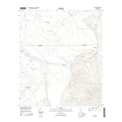
2014 Map of Hybart
USGS Topo · Published 2014About this map
The Alabama River meanders across the border of Wilcox and Monroe counties, carving a distinct landscape of sandbars and islands such as Saint James Bar and Steins Island. The river’s path defines the settlement patterns of this river-lowland region, where communities like Packards Bend and Tinela are situated along its broad reaches. Much of the local geography is defined by watercourses that feed into the main channel, including McCalls Cr, Tallatchee Cr, and the secluded Holly Br. Numerous family and community burial grounds, such as Tinela Cem and Pine Flat Cem, are tucked away near the small hubs of Asahel and Hybart, providing a window into the rural genealogy of the area. This map details the local road network connecting these hamlets, from Bell Landing Rd to Mt Gilliard Church Rd, illustrating the persistence of small-scale agriculture and timber-land ownership in the vicinity of Claiborne Lake.
Find a feature on this map
44 named features on this map. Tap any name to fly to it.
Don’t see what you’re looking for? This feature index may not catch every label — zoom into the map to look around manually.
Map Details
Editions of this 2014 Hybart Map
This is the sole edition of this map. No revisions or reprints were ever made.
Other maps of this area

1953 · Andalusia
USGS Topo · 1:250,000

1957 · Andalusia
USGS Topo · 1:250,000

1972 · Natchez
USGS Topo · 1:24,000

1972 · Franklin
USGS Topo · 1:24,000

1972 · Chance
USGS Topo · 1:24,000

1973 · Coy
USGS Topo · 1:24,000

1973 · Hybart
USGS Topo · 1:24,000

1973 · Pine Hill
USGS Topo · 1:24,000

1973 · Camden South
USGS Topo · 1:24,000

1973 · Lower Peach Tree
USGS Topo · 1:24,000