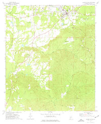
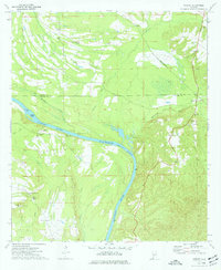
1973 Map of Camden South
USGS Topo · Published 1977About this map
Camden serves as the hub of this 1970s landscape, where the Louisville and Nashville railroad cuts across the northern terrain. The area is defined by a dense network of local landmarks, including the State Prison and Camp Camden just west of the town center. The civil infrastructure of the era is evident in the Camden Municipal Airport and the Radio Tower (WCOX), reflecting the mid-century growth of this Wilcox County region.
Find a feature on this map
32 named features on this map. Tap any name to fly to it.
Don’t see what you’re looking for? This feature index may not catch every label — zoom into the map to look around manually.
Map Details
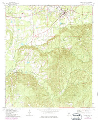
Editions of this 1973 Camden South Map
2 editions found
Other maps of this area

1953 · Montgomery
USGS Topo · 1:250,000

1953 · Andalusia
USGS Topo · 1:250,000

1956 · Montgomery
USGS Topo · 1:250,000

1957 · Montgomery
USGS Topo · 1:250,000

1957 · Andalusia
USGS Topo · 1:250,000
1957 · Carlowville
USGS Topo · 1:62,500
1973 · Coy
USGS Topo · 1:24,000
1973 · Hybart
USGS Topo · 1:24,000
1973 · Vredenburgh
USGS Topo · 1:24,000
1974 · Lee Long Bridge
USGS Topo · 1:24,000