
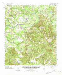
1957 Map of Carlowville
USGS Topo · Published 1958About this map
The Alabama River carves a deep horseshoe through the center of this landscape at Molette Bend, defining the border between Dallas Co and Wilcox Co. In the late 1950s, this region remained heavily focused on rural community life, anchored by a dense network of country churches and small schools. The Snow Hill Institute and Hopewell Sch (Abandoned) represent the educational history of the area, while the Elm Bluff Lookout Tower overlooks the wooded rises and swamps near Mush Creek. The settlement pattern follows the high ground above the river valley, with established communities like Carlowville, Richmond, and Portland connected by winding roads. This survey records a transition period in Alabama's Black Belt, documenting the locations of numerous family-named sites such as Molette Cem and Boykin Cem alongside industrial infrastructure like Minter (Minters Sta).
Find a feature on this map
60 named features on this map. Tap any name to fly to it.
Don’t see what you’re looking for? This feature index may not catch every label — zoom into the map to look around manually.
Map Details
Editions of this 1957 Carlowville Map
2 editions found
Other maps of this area

1953 · Montgomery
USGS Topo · 1:250,000

1953 · Andalusia
USGS Topo · 1:250,000

1956 · Montgomery
USGS Topo · 1:250,000

1957 · Montgomery
USGS Topo · 1:250,000

1957 · Andalusia
USGS Topo · 1:250,000

1957 · Benton
USGS Topo · 1:62,500

1957 · Braggs
USGS Topo · 1:62,500

1958 · Selma
USGS Topo · 1:62,500

1968 · Safford
USGS Topo · 1:24,000

1973 · Camden South
USGS Topo · 1:24,000