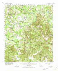
1957 Map of Carlowville
USGS Topo · Published 1973About this map
The Alabama River winds through a landscape of tight oxbows and fertile lowlands in this mid-century survey of the Dallas and Wilcox county border. The prominent horseshoe at Molette Bend anchors the northern half of the sheet, surrounded by several rural institutions including Molette Bend Sch and Molette Cem. Further south, the map reveals the educational and social network of the Black Belt region, featuring the historic Snow Hill Institute and the hilltop settlement of Carlowville.
Find a feature on this map
58 named features on this map. Tap any name to fly to it.
Don’t see what you’re looking for? This feature index may not catch every label — zoom into the map to look around manually.
Map Details
Editions of this 1957 Carlowville Map
2 editions found
Other maps of this area

1953 · Montgomery
USGS Topo · 1:250,000

1953 · Andalusia
USGS Topo · 1:250,000

1956 · Montgomery
USGS Topo · 1:250,000

1957 · Montgomery
USGS Topo · 1:250,000

1957 · Andalusia
USGS Topo · 1:250,000

1957 · Carlowville
USGS Topo · 1:62,500

1957 · Benton
USGS Topo · 1:62,500

1957 · Braggs
USGS Topo · 1:62,500

1958 · Selma
USGS Topo · 1:62,500

1968 · Safford
USGS Topo · 1:24,000