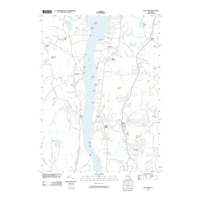
2010 Map of Hyde Park
USGS Topo · Published 2010About this map
The Hudson River bisects this river-valley landscape, serving as the central axis for a string of riverside settlements and estates. On the eastern shore, Hyde Park and Staatsburg are connected by a network of historic roads like Mills Mansion 2 Rd, while the western shore features the high ground of Shaupeneak Mountain overlooking Esopus and West Park. The presence of the Esopus Meadows Lighthouse offshore and landmark docks like Pelham Dock and Brown's Dock emphasize the longstanding maritime importance of the river corridor.
Find a feature on this map
98 named features on this map. Tap any name to fly to it.
Don’t see what you’re looking for? This feature index may not catch every label — zoom into the map to look around manually.
Map Details
Editions of this 2010 Hyde Park Map
This is the sole edition of this map. No revisions or reprints were ever made.
Other maps of this area

1893 · Poughkeepsie
USGS Topo · 1:62,500

1894 · Poughkeepsie
USGS Topo · 1:62,500

1898 · Rhinebeck
USGS Topo · 1:62,500

1901 · Rosendale
USGS Topo · 1:62,500

1903 · Poughkeepsie
USGS Topo · 1:62,500

1903 · Newburg
USGS Topo · 1:62,500

1903 · Rosendale
USGS Topo · 1:62,500

1934 · Rhinebeck
USGS Topo · 1:48,000

1936 · Poughkeepsie
USGS Topo · 1:48,000

1939 · Rhinebeck
USGS Topo · 1:62,500