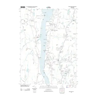
2013 Map of Hyde Park
USGS Topo · Published 2013About this map
Esopus Meadows Lighthouse stands as a maritime sentinel on the Hudson River, marking a stretch of the waterway where the tide-driven river meets a landscape of prominent points and coves. The 2013 survey of this region highlights the established estates and hamlets that define the eastern and western banks, including Staatsburg, West Park, and Haviland. Transportation history is visible through the New York Central Railroad Bridge and the Dock Street Bridge, which connect these riverfront communities to the water-based economy. Local heritage is preserved in numerous burial grounds such as Stoutenbergh Cem and the Ascension Church Cem, while the interior terrain is marked by family-named landmarks like Dinsmore Point and Maynard Farms, illustrating the deep-rooted agricultural and social history of Dutchess and Ulster Counties.
Find a feature on this map
217 named features on this map. Tap any name to fly to it.
Don’t see what you’re looking for? This feature index may not catch every label — zoom into the map to look around manually.
Map Details
Editions of this 2013 Hyde Park Map
This is the sole edition of this map. No revisions or reprints were ever made.
Other maps of this area

1893 · Poughkeepsie
USGS Topo · 1:62,500

1894 · Poughkeepsie
USGS Topo · 1:62,500

1898 · Rhinebeck
USGS Topo · 1:62,500

1901 · Rosendale
USGS Topo · 1:62,500

1903 · Poughkeepsie
USGS Topo · 1:62,500

1903 · Newburg
USGS Topo · 1:62,500

1903 · Rosendale
USGS Topo · 1:62,500

1934 · Rhinebeck
USGS Topo · 1:48,000

1936 · Poughkeepsie
USGS Topo · 1:48,000

1939 · Rhinebeck
USGS Topo · 1:62,500