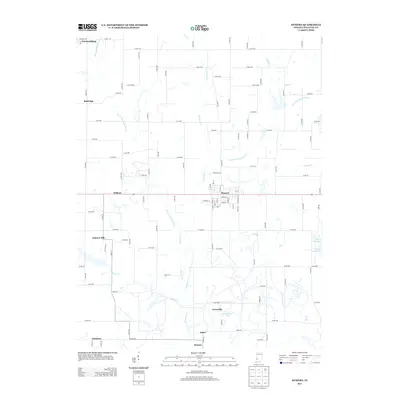
2013 Map of Hymera
USGS Topo · Published 2013About this map
Hymera serves as the central hub of this Sullivan County landscape, where the local road network converges around a core of named streets like White Ash Dr and Orchard St. The surrounding countryside is defined by the branching drainage of Busseron Cr, including its West and East Forks, which carve through a region dotted with smaller settlements such as Jackson Hill, Wilfred, and Baldridge. The presence of Lake Kickapoo and Greenbriar Lake provides a contrast to the geometric grid of county roads that crisscross the terrain. To the north, the map includes the southern edge of Farmersburg, while to the south, the clusters at Greenville, Baker, and Hawton reflect the persistent rural settlement patterns of the early 21st century. The map effectively documents the transition between small town centers and the agricultural and water-rich corridors of western Indiana.
Find a feature on this map
55 named features on this map. Tap any name to fly to it.
Don’t see what you’re looking for? This feature index may not catch every label — zoom into the map to look around manually.
Map Details
Editions of this 2013 Hymera Map
This is the sole edition of this map. No revisions or reprints were ever made.
Other maps of this area

1908 · Clay City
USGS Topo · 1:48,000

1910 · Clay City
USGS Topo · 1:62,500

1940 · Lewis
USGS Topo · 1:24,000

1940 · Linton
USGS Topo · 1:24,000

1940 · Jasonville
USGS Topo · 1:24,000

1940 · Pimento
USGS Topo · 1:24,000

1942 · Shelburn
USGS Topo · 1:24,000

1943 · Hymera
USGS Topo · 1:24,000

1943 · Sullivan
USGS Topo · 1:24,000

1943 · Dugger
USGS Topo · 1:24,000