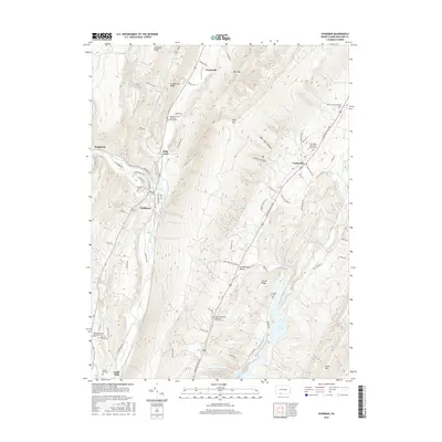
2016 Map of Hyndman
USGS Topo · Published 2016About this map
Hyndman sits at the confluence of several mountain streams in a landscape defined by the parallel ridges of Wills Mtn and Shriver Ridge. This Bedford County terrain is marked by a deep genealogical footprint, with numerous family and church burial grounds scattered across the valleys. To the north, the Oakford / Glen Carpenter Farm Cem and Bortz Lutheran Church Cem document early settlement patterns, while the southern reaches near Cooks Mills feature the Cooks Mill Cem and Palo Alto United Methodist Church Cem. The valley floor is shaped by the waters of Wills Creek and its many tributaries, including Gooseberry Run and Little Wills Cr, which eventually flow toward the significant reservoirs of Lake Koon and Lake Gordon. These reservoirs, along with features like Mill Gap, highlight the long-standing management of water resources within this ridge-and-valley corridor.
Find a feature on this map
81 named features on this map. Tap any name to fly to it.
Don’t see what you’re looking for? This feature index may not catch every label — zoom into the map to look around manually.
Map Details
Editions of this 2016 Hyndman Map
This is the sole edition of this map. No revisions or reprints were ever made.
Other maps of this area

1898 · Frostburg
USGS Topo · 1:62,500

1899 · Flintstone
USGS Topo · 1:62,500

1900 · Flintstone
USGS Topo · 1:62,500

1901 · Frostburg
USGS Topo · 1:62,500

1908 · Frostburg
USGS Topo · 1:62,500

1923 · Berlin
USGS Topo · 1:48,000

1927 · Hyndman
USGS Topo · 1:62,500

1929 · Berlin
USGS Topo · 1:62,500

1931 · Hyndman
USGS Topo · 1:62,500

1944 · Hyndman
USGS Topo · 1:62,500
Featured Places
- Hyndman, PA
- Londonderry Township, PA
- Southampton Township, PA
- Harrison Township, PA
- Cumberland Valley Township, PA