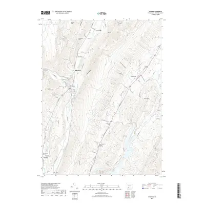
2019 Map of Hyndman
USGS Topo · Published 2019About this map
Wills Creek and its namesake valley form the primary corridor for this 2019 survey of the mountainous Pennsylvania-Maryland borderlands. The borough of Hyndman sits at the intersection of Wills Creek and Little Wills Cr, serving as a central hub for the CSX Transportation railroad and the Hyndman PO. This region is defined by prominent north-south ridges including Wills Mtn and Shriver Ridge, which channel development into tight valleys like Cumberland Valley.
Find a feature on this map
83 named features on this map. Tap any name to fly to it.
Don’t see what you’re looking for? This feature index may not catch every label — zoom into the map to look around manually.
Map Details
Editions of this 2019 Hyndman Map
This is the sole edition of this map. No revisions or reprints were ever made.
Other maps of this area

1898 · Frostburg
USGS Topo · 1:62,500

1899 · Flintstone
USGS Topo · 1:62,500

1900 · Flintstone
USGS Topo · 1:62,500

1901 · Frostburg
USGS Topo · 1:62,500

1908 · Frostburg
USGS Topo · 1:62,500

1923 · Berlin
USGS Topo · 1:48,000

1927 · Hyndman
USGS Topo · 1:62,500

1929 · Berlin
USGS Topo · 1:62,500

1931 · Hyndman
USGS Topo · 1:62,500

1944 · Hyndman
USGS Topo · 1:62,500
Featured Places
- Hyndman, PA
- Londonderry Township, PA
- Southampton Township, PA
- Harrison Township, PA
- Cumberland Valley Township, PA